FREN Book a demoDemo →
Infrastructure operators

Assess and determine the value of your complex real estate holdings

Netcarbon helpsInfrastructure operators operators create a baseline assessment of their complex land holdings, balance different land uses, and enhance the value of their projects using reliable and verifiable data.

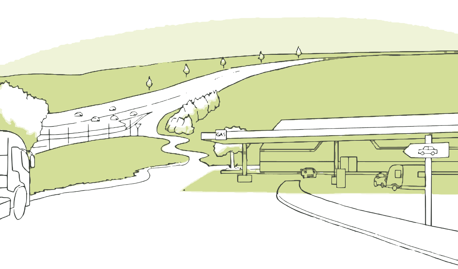
Drawing of a road lined with vegetated embankments
Typical Projects: Airports, highways, railways and rail yards, parking lots, linear rights-of-way
Use cases

Frombaseline assessment to recovery

Five ways to understand your land holdings, decide how to use them, and maximize your returns.

1/5

Assess Your Land Holdings

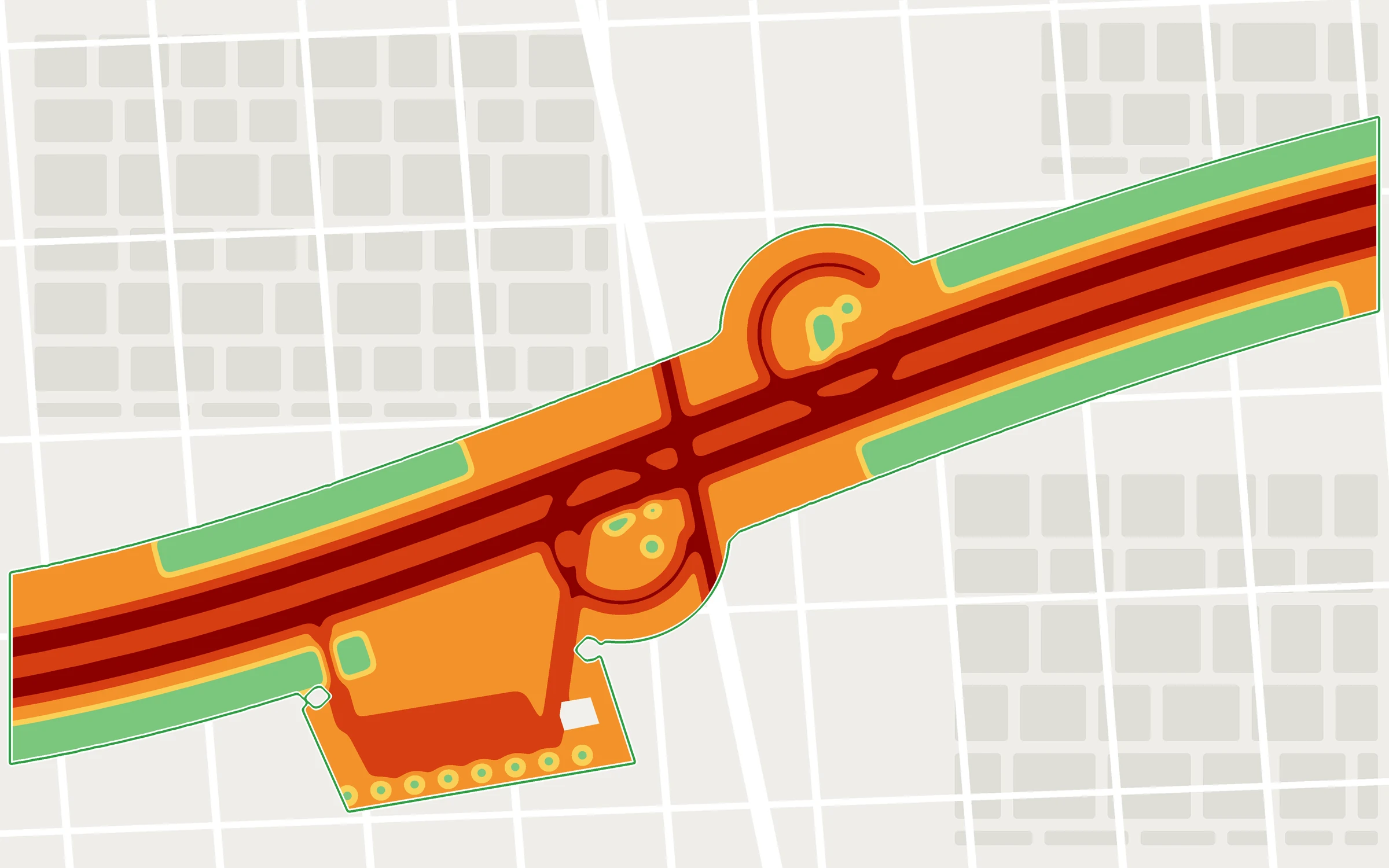
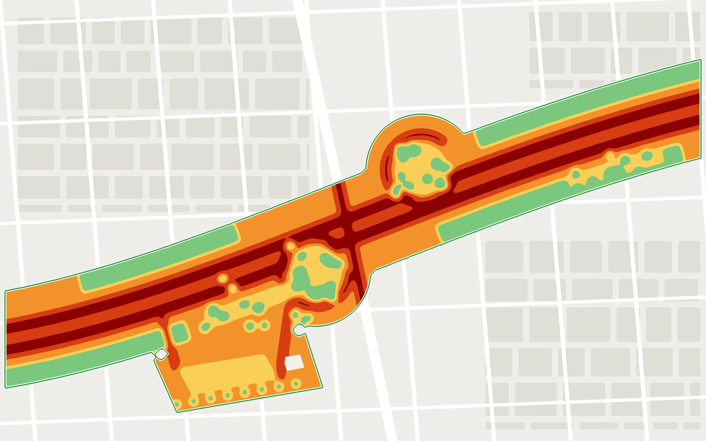
Conduct a detailed analysis of complex land parcels using a multi-indicator approach: biodiversity, carbon, land cover, land conversion, and more. Identify sensitive areas and develop your action plans.

  • Multi-indicator approach
  • Identified Sensitive Areas
  • Structured Action Plans
land cover a hypothetical highway right-of-way: interchange, embankment, and rest areaCarbon stock within the same highway right-of-way
2/5

Develop Your Strategy

Define a carbon sequestration pathway for your entire landholding. Using the built-in macro-calculator, simulate changes in landland cover , and estimate their impact on carbon stocks.

  • Carbon Sequestration Pathway
  • Built-in macro calculator
  • A vision for the entire property
Carbon CalculatorChanges toland cover
Mineral → meadow2.8 ha
Mineral → Afforestation1.1 ha
Meadow → Afforestation0.5 ha
Estimated potential over 25 years+784 metric tons of CO₂
3/5

Decide on usage policies on a site-by-site basis

Make your strategy operational by managing trade-offs on a site-by-site basis: identify areas to preserve or restore to their natural state, as well as those best suited for various uses (solar power, restoration, development, etc.).

  • Site-Driven Arbitrations
  • Areas to be preserved or restored
  • Photovoltaic Potential
Potential of the Right-of-WayPossible Uses, Site by Site
Possible uses on a hypothetical highway right-of-way: embankments to be preserved, abandoned areas to be restored to their natural state, parking lot for solar panels
To be preservedTo restoreSolar Power
4/5

Simulate the impact of your projects

Measure the environmental impact of a project (solar power, habitat restoration, etc.) before it is implemented. Test different scenarios to optimize the impact.

  • Photovoltaic and Renaturation Projects
  • Comparison of Scenarios
  • Impact assessed prior to construction
Preliminary DesignAfter the projectPreliminary DesignAfter the project
5/5

Showcase Your Environmental Initiatives

Monetize the benefits generated through your carbon footprint assessments (GHG Protocol , LSRG) or through certified carbon credits. Strengthen your CSR strategy with tangible evidence.

  • GHG Protocol LSRG
  • Certified carbon credits
  • Evidence to Support Your CSR Strategy
DiagnosisProjectCalculationEvaluation
Carbon Footprint · GHG Protocol LSRG+784 tCO₂in estimated savings, which can be incorporated into your balance sheetRecoverable
Reference Project

Airport Nantes Airport

BouguenaisNantes Atlantique Airport202529 haImpact Study

Analysis of the initial conditions and modeling of various development scenarios (renaturation and photovoltaic shade structures) to assess the impact on carbon stocks, surface temperature , andland take. The study provided an objective basis for design trade-offs and helped guide the development strategy.

View the project
−6.3 °Cthermal comfort
+784.8 metric tons of CO₂Carbon stock
+4.4 haDe-impermeabilized
29 haProject area

Other ProjectsTechnicentre TER Bretagne · RennesVinci Autoroutes Land Holdings · Throughout France

Our Offer

Your land holdings or a project

An assessment of all your right-of-way properties, or a study focused on a restoration or solar power project. Pricing is based on the length or area analyzed.

Project Proposal

A project, with support

  • Simulation of a restoration or solar power project
  • Comparison of Scenarios
  • Detailed Report
  • Monetization of Carbon Credits
Get a quote
Assessment of Right-of-Way Areas

All Your Real Estate in the App

  • Multi-Indicator Assessment of Land Use
  • Arbitration of Usage Practices
  • Carbon Calculator Macro
  • Exports and GIS Layers
Get a quote →
Frequently Asked Questions

Infrastructures, vos questions

Is it possible to analyze an entire network?

Yes. The assessment can cover an entire property and then be broken down by district, site, or parcel.

How do you compare wetland restoration and solar power?

Each land use is simulated as a scenario, and its impacts (carbon, temperature, land cover change) are compared using the same indicators.

Can these gains be included in our carbon footprint?

Gains can be recognized on your balance sheets under the Act on the Sustainability of the Energy System ( GHG Protocol , or LSRG) or through certified carbon credits.

What file formats should our GIS teams use?

The results can be exported as GIS layers, spreadsheets, and PDF summaries, and are accessible via API.

Demonstration

Measure the impact of your next project, starting with the initial sketch.

30 minutes on an area of your choice, with an expert Netcarbon.

Book a demo →

Any other questions? Write to us