The Customer - Bordeaux Métropole
With 116,000 residents, 11 communes, and 5,000 hectares of protected nature, Bordeaux's Arc Rive Droite is an area in full ecological transformation and economic development. The project, L'Opération d'Intérêt Métropolitain Arc Rive Droite, launched in 2021, aims to contribute to the attractiveness of the metropolis and create an economic dynamic for all the communes in the agglomeration.
The project in figures
.png)
The Challenge
Revitalizing a territory for the planet and its inhabitants: how to think about more sustainable development?
- Analyze the territory and its history at a global level.
- Calculate the current impact of existing natural assets, then consider ways of improving and preserving them.
- Simulate the impact of projects and identify the best solutions for carbon capture.
- Propose improvement scenarios to help solve current and future problems linked to climate change, such as heat islands and flooding caused by soil sealing....
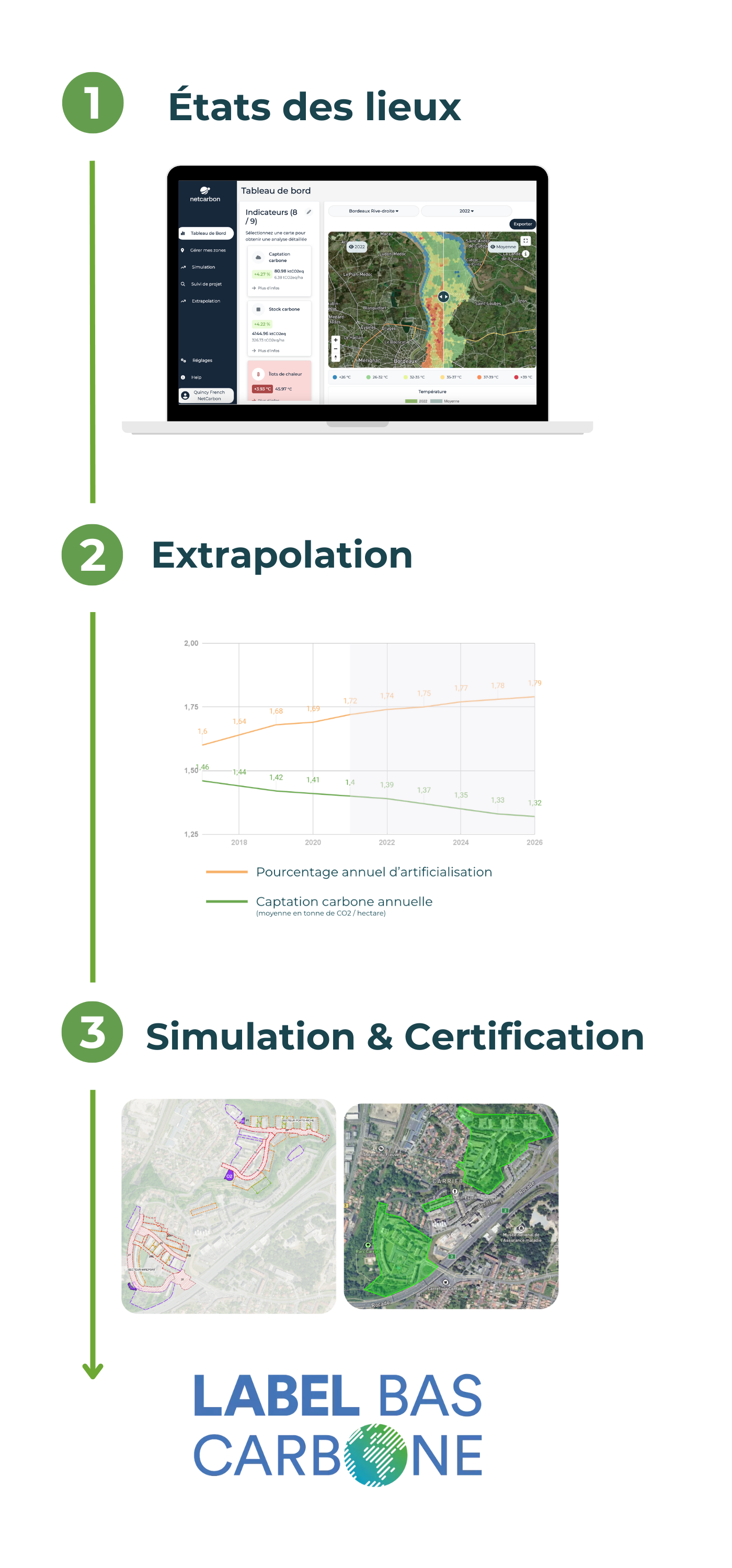
Project milestones: Netcarbon x Bordeaux Metropole
Designing tomorrow's urban development projects with satellite imagery and artificial intelligence
To achieve this objective, precise measurements and continuous monitoring are essential. To this end, Bordeaux Métropole collaborated with Netcarbon to launch an innovative market for measuring carbon capture in the region. Netcarbon's technology, based on artificial intelligence and satellite imagery, provided them with real-time data.


Netcarbon began with a comprehensive assessment of the situation from 2018 to 2022, focusing on carbon storage and capture, heat islands and vegetation cover. Land artificialisation was also analyzed, a new indicator developed in collaboration with Bordeaux Métropole.
Based on measurements taken between 2018 and 2022, an extrapolation has been made to project the Bordeaux Right Bank 10 years ahead.
Bordeaux Métropole has selected two major development projects. Netcarbon tools can be used to simulate the impact of these projects on carbon storage, soil artificialisation and UHI. For each of these projects, the aim is to be able to meet the requirements of the Low Carbon Label to certify the emission reductions thanks to the renaturation actions carried out.
Why Netcarbon?
Transform your carbon capture and storage projects with accurate real-time data
.png)
Netcarbon collects and processes large-scale satellite data, producing a set of indicators linked to carbon storage. These indicators have enabled Bordeaux Métropole to identify the most relevant renaturation and urban development projects, while locating potential heat islands, in order to promote the development of an ecological metropolis.
For a demonstration or to find out how Netcarbon can contribute to your territory and your development projects, contact us today!


.webp)


